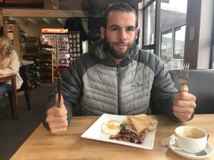
Time is racing! The first week of Term 2 is already over and I still haven`t written about our epic trip to the Fiordlands. Despite Louie and me working over the holidays, we found ourselves around Easter 4 days free and jumped into the car to head down to the Fiordlands. Fiordland is a fairly large conservation area at the southern end of the South Island. Mainly covered in dense native bush, Fiordland is famous for its steep waterborn mountains of the Milford sound.
Louie and me don`t drive that far. Our chosen destination is Manopouri a small area about one hour drive away from Te Anau (the main hub of the area).
Our ideal goal: Mt Titiroa, one of the highest elevations here and a peak with no marked track leading to its top.
Our challenge: Louies back (age and sport has finally got him, since weeks he is suffering from a very painful issue with his sciatic nerve).
Our plan: Short 3-4 hour walk in on day one, Simone carries the heavy bag and we decide on day two if we are really heading to Mt Titiroa or find some easier way out.
The exciting start of our Trip: Between Manopouri and the start of the tracks flows a fairly wide river that can only be crossed by boat. The elderly, granddad-like captain works on call and is friendly enough to manoeuvre us not just to the other side but to give us a head start by dropping us a bit ahead of the track.
So good to be on a tramp again! We walk through the damp beach forest, followed by curious Fantails and Tomtits and enjoy the remoteness and wilderness of this place. Around three hours later we reach the doc hut and decide to stay here for this first night. An other option would have been to continue walking through the bush to reach a river on the bottom of Mt. Titiroa where we could have camped. Staying in the hut is a good option for today. No need to take extra risks with Louies back. The imagination of him waking up next day all stiff, in pain and unable to walk out is not a very inviting one. The peaceful lake can only be enjoyed for about 30 seconds. Anyone who stays much longer close to the shore gets eaten alive by the merciless sandflies. A fire keeps us warm and some Possums keep us entertained, unfortunately our carefully aimed rocks miss them and our attempt to save some native birds fails.
We start early on day two after a night of roaring deers and animals rummaging outside the hut. Louie feels good and we decide to head closer to Mt. Titiroa and push our decision about todays route a bit further. After 2 hours of beach forest he still feels good and fit und all of a sudden the dense bush opens up into a open, tussock covered valley. The morning light dries up the dew and the sunny valley is decorated with the last mist. NZs beauty! Our decision about wether or not trying to cross Mt. Titiroa is soon made, we will give it a go. That means that we will add a good 1300 meters of altitude to the 300 already mastered.
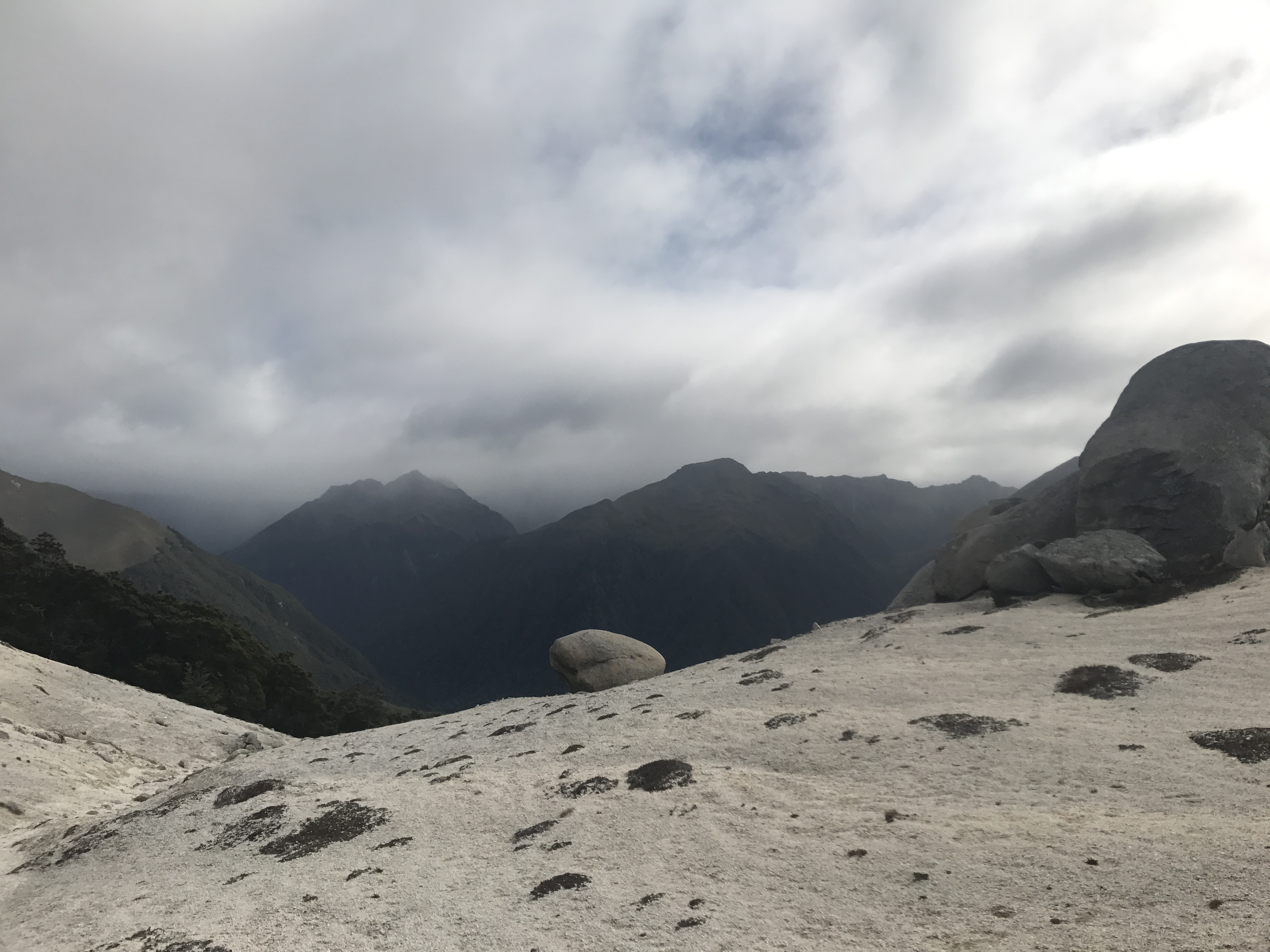
From here, navigation will be up to us; the frequent orange plastic triangles will be non-existant as soon as we cross this river. On the other side of the water, steep, bush- covered hills emerge and thanks to our maps we soon know which one we will have to climb. Our first attempt to bash through the incredible thick bush close to the river comes to an unsuccessful end in a swamp. Its proves to be incredible hard to keep a direction/orientation once we are crawling through the wood. Nevertheless we soon find a way to higher and more open ground and from here on, finding the right direction this time is easy, just steep uphill. And up it is. We follow tiny deer paths, climb around boulders and around numerous fallen trees. The terrain is steep and our way towards the top couldn t be more straight forward. After about 2 hours of sweating and climbing, we reach a clearing and soon after we get the first breathtaking views. Fiordland at its best with shimmering blue lakes and rivers nested in between bush covered hills and steep backbones of the montains closer by suck is into this mesmerising landscape. Our time in the bush has come to an end for today and from now on, we gain hight above the bushline and are fascinated by the quickly changing landscape. Up here walking is much easier. Gravelly patches make moving smooth and soon we reach the first impressive boulders resting on the shoulders of Mt Titiroa. Clouds are building up and hide the higher peaks ahead. Its getting cold and we know that we don t have any time to waste today. If we keep moving in a reasonable pace, we will still be on our feet for at least 9 hours. There is no way we want to end up camping on the top of the mountain or anywhere too high. Our minimum goal is to reach a couple of lakes we spotted on the map a couple of 100 meters below the peak. So breaks are kept short which is encourage by the much cooler temperatures and the rain up here. Once more it is impressive how quickly the vegetation and weather changes to “alpine” in New Zealand. As we move upwards the weather worsens. Short showers come and go and the clouds only open up occasionally to reveal a breathtaking view over zigg-zagged fins and sharp ridges. We are climbing over rocks and gravel, traversing large slips and feeling minuscule in between the large rock faces, boulders and slips. Orientation becomes quite difficult and the best we can do is try to follow a certain contour line. Eventually we recognise two small lakes on a saddle that are marked on the map and at least for now we know exactly where we are. By now we have given up the idea to stand on the peak of Mt Titiroa but focus on a safe descent to lower areas that are hopefully suitable for a camp. Carefully we move around the highest peak and end up climbing up to the ridge line anyway. To reach our lakes we need to follow this sharpe ridge from here on. Fog and clouds make it once more hard to navigate and we can t be sure about our position on the ridge.
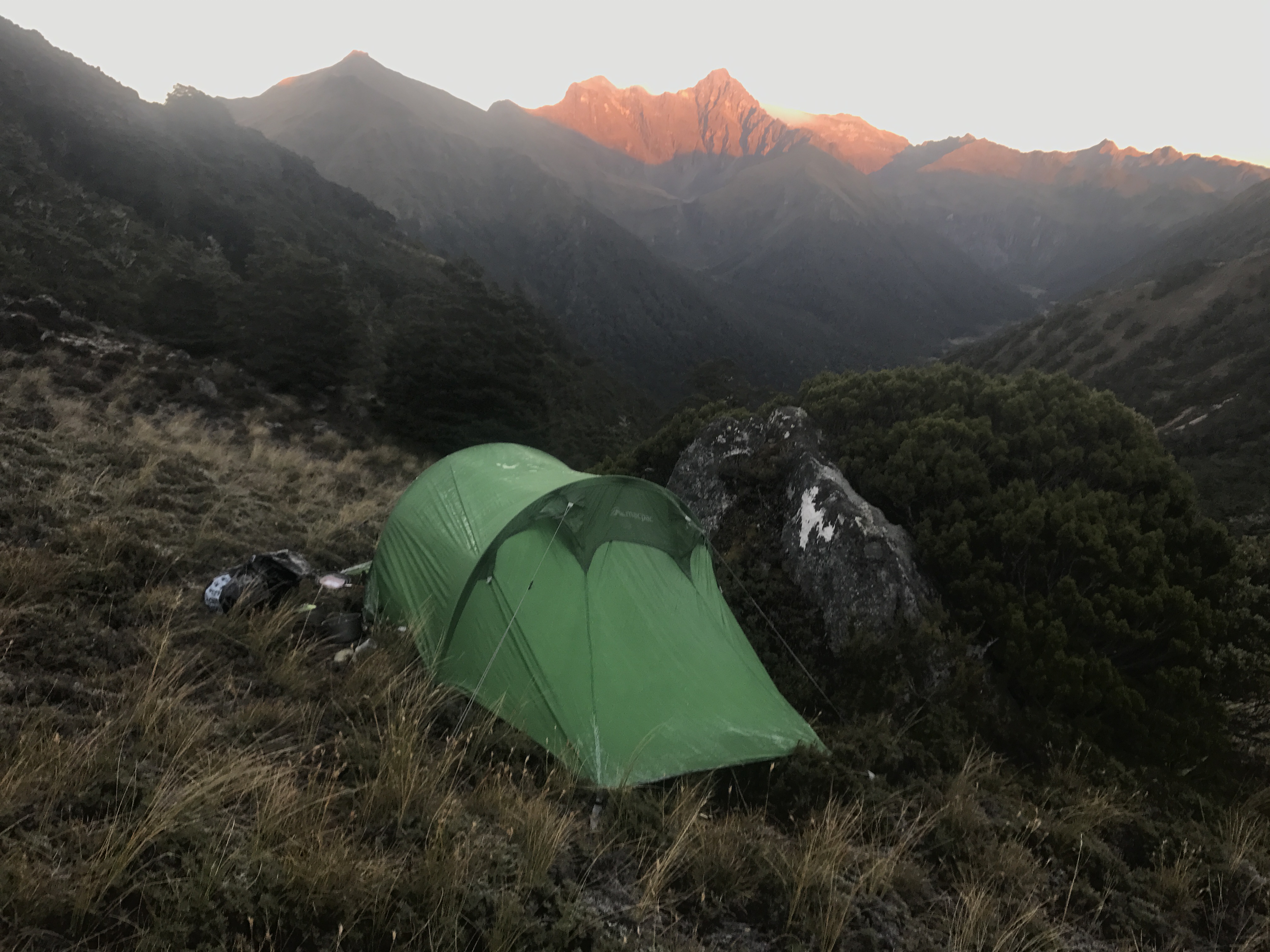
After following the ridge for a while we decide to go for the descent on the other side, hopefully to those lakes. The descent is very, very steep and after the first 200 meters or so also very very wet. Gravel and rocks are replaced with soaked wet grass and moss and small creeks emerge from all over the place. Finally after 12 hours of walking we spot the lakes and the first trees through the fog and we start looking out for a convenient (flat) spot for our tent. By now it is raining and we are pretty wet and cold. We cook our well deserved dinner laying in our sleeping bags and it feels good to be warm, dry and refuelled with a yummy corn and tuna stew.
Fast asleep we believe to know that tomorrow will be an easy mission, a steep descent through the forest down to a tinny tiny doc hut and then a long, more or less horizontal walk out. I am kind of glad we didn`t know better.
The awakening next day is a cold one. We are all dry and warm, but the night was cold enough to cover the grass, bushes and our tent with an icy layer. The rain has stopped, the fog went elsewhere and the blue sky promises an awesome day. This feeling to get up and finally see where you are, on more or less flat shoulder of a steep slope, morning sun just reaching the surrounding jagged peaks…A really good feeling!
After breakfast in the tent we try to pack up as fast as possible. Once out of the sleeping bag it is freezing and the wet pants, shoes and frozen socks don`t make it any better. The only medicine we have is to get moving as fast as possible. Since we still believe that we are next to the lakes on the map we dive straight down into the think bush and try our best to find a way through the incredibly dense undergrowth. Our orientation point is a creak that we try to follow. All too often we are forced back into the bush because the creek cascades down some waterfalls. It is wet, steep and with our bags we get caught in the undergrowth all the time. At some points it is so steep, that all we can do is hold on the whatever branches and grasses seem trustworthy enough. Several points we have to turn around because there is not even an opening big enough to crawl through. To avoid a massive drop we climb back up and to the side and end up standing on top of another vertical drop that opens up a great view into another side valley. We finally come to the realisation that we are definitely not were we thought were yesterday. Those lakes nearby are not on our map and we didn t walk down the ridge we intended but a much steeper side of the ridge. After one more briefing we decide that our best and safest way out of this is to climb all the way back up to where we camped and traverse to actual lakes. Three hours after leaving camp we reach our starting point. What a warm up! Another 2 hours later we reach the lakes and from there we start our second descent to the valley. This time the tree line greets us with much more open forest and also a less steep terrain. What a relief! After only 40 minutes we reach the bottom of the valley and soon we stand in front of the cute little North Borland Hut. I am relieved and very glad about the decisions we made today. Lots of decisions. I am proud of us as a couple and team that we managed once again to keep clear heads, good spirits and find solutions in tricky situations.
Our “easy walk out” turns out to be a pretty long stretch (marked though) through a nice but dark forest with many ups and downs and zig and zags. 5 hours later and once again in a fight with the day light, we stand in front of a sign board giving us two options, either an 1 hour to a slightly wrong direction (detour) but to the right road or an 1.5 hours to the place we actually want to go but with the prospect of walking in a pitch black forest for a while. We choose the detour and try our best to reach that road before complete darkness. What we didn`t know was this way includes a mean ascent and we end up climbing up (again) for another 45 min. And then, just in time, we meet the gravel road. Our plan to get a hitch out of here is pretty hopeless considering the time (7.30 pm) and remoteness of the place. But we are out of the bush, away from sudden drops, roots and other obstacles. All we have to do is keep walking, looking at the stars and licking the last bit of peanut butter out of the jar.
After another hour walking in complete darkness and the freezing cold we reach the Monowai River Lodge. There are people and the Lodge is open and running and we get ourselves a flat camping space next to the large, deserted industrial kitchen and dining hall. After pitching the tent only one thought occupies our minds, food. After this extremely draining but rewarding 12 hour hike all we want is eat and sleep.
The next day we get up early again and despite the rain we get going, trying to keep our hopes for a ride as low as possible. Lucky lucky us after less than a 1/2 hour walk a car comes our way and stops and the friendliest, funniest family of four somehow manages to squeeze us in between fishing rods and bumper seats. Those awesome people keep us well entertained the whole drive back to our car in Manapouri. We wish we could keep them as friends for a lifetime.
End of the trip :).